English Below
L’IH.SM rejoint le consortium MarCOSIO et forge ainsi de nouveaux partenariats dans la région Sud de l’Afrique et dans l’Océan Indien
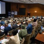
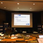
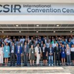
L’atelier de démarrage du projet MarCOSIO (Marine and Coastal Services in the Indian Ocean) a eu lieu à Pretoria (Afrique du Sud) du 26 au 29 Septembre 2022.
C’est un projet financé par l’Union Africaine, incluant plusieurs organisations de la région Sud de l’Afrique et de l’Océan Indien tels :
- Council of Scientific and Industrial Research – CSIR (Afrique du Sud),
- ABALOBI (Afrique du Sud),
- Benguela Current Convention – BCC (Namibia, Angola),
- Coastal Oceans Research Indian Ocean East Africa – CORDIO (Kenya),
- Institute of Marine Sciences, University of Dar es Salaam – IMS (Tanzania),
- Kenya Marine Fisheries Institute – KMFRI (Kenya) ,
- Mauritius Oceanography Institute – MOI (Maurice),
- National Sea Rescue Institute – NSRI (South Africa),
- Tanzania Fisheries and Research Institute – TAFIRI (Tanzania),
- University of Eduardo Mondlane (Mozambique),
- Western Indian Ocean Marine Science Association – WIOMSA (Tanzania),
- Institut Halieutique et des Sciences Marines – IH.SM (Madagascar)
MARCOSIO mettra à la disposition des utilisateurs différents services tels:
- Soutien à la pêcherie: Fournit aux pêcheurs de différents secteurs et aux décideurs les outils permettant d’optimiser l’effort de pêche, d’améliorer la sécurité en mer, de mieux comprendre la variabilité de l’environnement et de surveiller la pêche illégale, non déclarée et non réglementée (INN) et l’effort de pêche. Une attention particulière sera accordée au soutien des communautés de pêcheurs à petite échelle par le biais du partenariat ABALOBI.
- Soutien à l’aquaculture: Les décideurs auront la possibilité d’être avertis des occurrences de marées rouges.
- Ecosystème côtiers: Fournit aux décideurs, aux gestionnaires et aux ministères de l’environnement et de la pêche une cartographie précise des écosystèmes côtiers ainsi que le suivi de leurs changements, qu’ils soient saisonniers ou anthropiques.
- Suivi de blanchissement de coraux: Le service permettra d’évaluer les alertes de blanchiment historiques et en temps réel, et offrira la possibilité d’évaluer d’autres éventuels sources de stress pour les coraux.
- Le suivi des bateaux de pêche : Les décideurs auront la possibilité de surveiller les navires coopératifs opérant dans leur ZEE et d’obtenir des informations stratégiques sur les navires non coopératifs..
- La sécurité en mer: Les organisations de recherche et de sauvetage en mer peuvent utiliser ce service pour aider à la planification des opérations de recherche et de sauvetage en mer.
Ces services sont pleinement opérationnels dans les autres régions du Sud de l’Afrique et dans l’Océan Indien. Durant la mise en œuvre du projet, l’Institut Halieutique et des Sciences Marines (IH.SM), à travers le Centre National des Données Océanographiques (CNDO) veillera à ce que Madagascar puisse également bénéficier de ces services et technologies.
Par ailleurs, l’IH.SM dirigera aussi le groupe de travail concernant le renforcement de capacité sur l’utilisation des outils géospatiaux pour les observations marines et côtières.
IH.SM joins the MarCOSIO consortium and establishes new partnerships in the Southern African region and in the Indian Ocean.
The launch workshop of the MarCOSIO project (Marine and Coastal Services in the Southern Africa and in the Indian Ocean) took place in Pretoria (South Africa) from 26 to 29 September 2022.
This is a project funded by the African Union, including several organizations in the Southern Africa and Indian Ocean region such as:
- Council of Scientific and Industrial Research – CSIR (South Africa),
- ABALOBI (South Africa),
- Benguela Current Convention – BCC (Namibia, Angola),
- Coastal Oceans Research Indian Ocean East Africa – CORDIO (Kenya),
- Institute of Marine Sciences, University of Dar es Salaam – IMS (Tanzania),
- Kenya Marine Fisheries Institute – KMFRI (Kenya),
- Mauritius Oceanography Institute – MOI (Mauritius),
- National Sea Rescue Institute – NSRI (South Africa),
- Tanzania Fisheries and Research Institute – TAFIRI (Tanzania),
- Eduardo Mondlane University (Mozambique),
- Western Indian Ocean Marine Science Association – WIOMSA (Tanzania),
- Institut Halieutique et des Sciences Marines – IH.SM (Madagascar)
MarCOSIO will provide users with different services such as
– Fisheries support: Provides fishermen from different sectors and decision makers with tools to optimize fishing effort, improve safety at sea, better understand environmental variability, and monitor illegal, unreported and unregulated (IUU) fishing and fishing effort. Special attention will be given to supporting small-scale fishing communities through the ABALOBI partnership.
– Support for aquaculture: Decision makers will have the opportunity to be informed of red tide events.
– Coastal Ecosystems: Provides policy makers, managers, and environment and fisheries ministries with accurate mapping of coastal ecosystems and monitoring of their changes, both seasonal and anthropogenic.
– Coral Bleaching Monitoring: The service will assess historical and real-time bleaching alerts and provide the ability to assess other potential sources of stress to corals.
– Fishing Vessel Tracking: Decision makers will be able to track cooperative vessels operating in their EEZ and obtain strategic information on non-cooperative vessels.
– Safety at Sea: Search and rescue organizations at sea can use this service to assist in planning search and rescue operations at sea.
These services are fully operational in other parts of Southern Africa and the Indian Ocean. During the implementation of the project, the Institut Halieutique et des Sciences Marines (IH.SM), through the MD-NODC (Madagascar-National Oceanographic Data Center), will ensure that Madagascar can also benefit from these services and technologies.
In addition, IH.SM will lead the working group on capacity building in the region on the use of Earth observation tools for marine and coastal environments.


